Our Services

Atlas's, Guides and Paper Maps

Survey

Map Dev since its inception, has produced a large number of indicative maps and atlases, whether as a private production or for the benefit of various government agencies, MapDev. Became a pioneer in this field.

Map Dev Professional Services

Map Dev FAQ'S

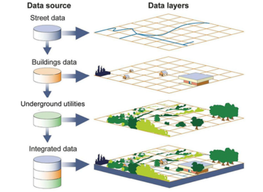
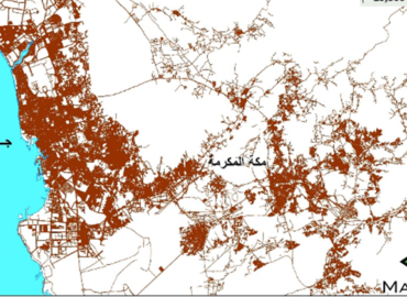
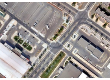
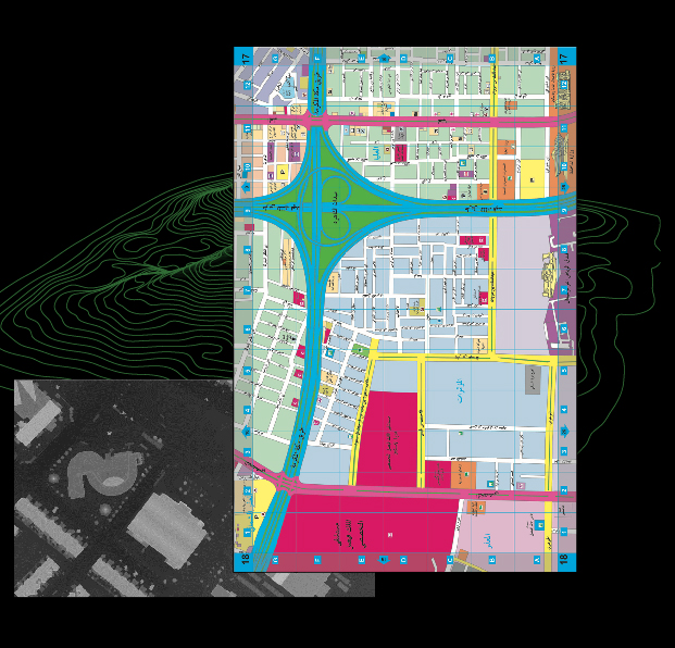
A GIS is a system designed to capture, store, manipulate, analyze, manage, and present spatial or geographic data. It integrates hardware, software, and data for capturing, managing, analyzing, and displaying all forms of geographically referenced information.

A GIS system typically consists of hardware (computers, GPS devices, etc.), software (GIS software), data (spatial data and attribute data), people (GIS professionals), and procedures (workflows and methodologies for data management, analysis, and visualization).

Geo Database Updating & Survey involves updating spatial databases with current and accurate information through various surveying techniques. It’s crucial for maintaining the currency and accuracy of spatial data used in GIS applications, ensuring informed decision-making and analysis.

Common methods include field surveys using GPS devices, aerial surveys using drones, satellite imagery interpretation, ground truthing, and crowd-sourcing data collection techniques.

Drones offer advantages such as cost-effectiveness, rapid data collection, high-resolution imagery, accessibility to remote or hazardous areas, and flexibility in flight patterns and data acquisition.

Remote sensing involves acquiring information about objects or areas from a distance, typically through aerial or satellite sensors. In GIS applications, remote sensing data (e.g., satellite imagery, aerial photographs) are used for mapping, monitoring land use/land cover changes, environmental assessment, disaster management, etc.

Common remote sensing platforms include satellites, aircraft (manned and unmanned), and drones. Each platform offers different capabilities in terms of spatial resolution, spectral bands, revisit frequency, and cost.

GIS provides the framework for storing, analyzing, and visualizing spatial data, while remote sensing offers a means to acquire that data. Together, they enable the integration of diverse data sources for comprehensive spatial analysis and decision-making.

Applications include habitat mapping, biodiversity assessment, deforestation monitoring, urban planning, watershed management, climate change analysis, and natural disaster response and mitigation.

Essential skills include spatial analysis, data management, programming (e.g., Python), remote sensing techniques, cartography, communication, and domain knowledge in areas such as geography, environmental science, urban planning, or agriculture.

Unlock the Potential of GIS with MAP DEV

Pellentesque sem velit sagittis nec viverra vel fermentum sed sem. Praesent ac fringilla arcu dictum.

Founded in 1982, Map Dev pioneers in geospatial and mapping technologies in Saudi Arabia, providing comprehensive consultative, development, and executive services.

Our Services

Copyright 2024 © Map Dev | All rights reserved.