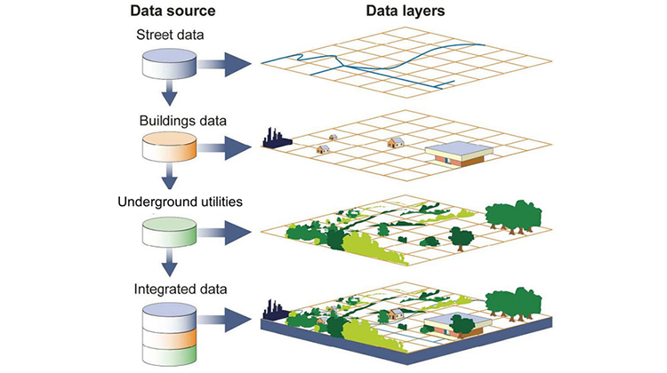
A geographic information system (GIS) is a computer system for capturing, storing, checking, and displaying data related to positions on Earth’s surface. GIS can show many different kinds of data on one map, such as streets, buildings, POI’s And underground utilities. This enables people to more easily see, analyze, and understand patterns and relationships.

Unlock the Potential of GIS with MAP DEV

Pellentesque sem velit sagittis nec viverra vel fermentum sed sem. Praesent ac fringilla arcu dictum.

Founded in 1982, Map Dev pioneers in geospatial and mapping technologies in Saudi Arabia, providing comprehensive consultative, development, and executive services.

Our Services

Copyright 2024 © Map Dev | All rights reserved.