Folded Maps

Map Dev are the first series of maps to be produced for the Kingdom of Saudi Arabia and its major cities. These maps show the road networks in the Kingdom and its major cities in different classifications and important public and private services indexes of street names in alphabetical order with a grid reference.

On the Kingdom's level, locations of cities and towns are displayed on the maps including the distances between main intersections.

Jeddah Map

A folded map of Jeddah printed on two sides; (Front) General Map at 1:50,000 scale showing the districts including the new districts east of the high-way and north of Ubhur Creek. This side also includes an inset showing the road network between Jeddah, Makkah and Taif, with an index for historical sites, government and private services.

Size : 100cm x 70cm

Price : SR. 28.75

Madinah Munawwarah Map

A folded map of two sides: Front side showing a General Map of Madinah Region at 1:1M, contains the road network and locations of cities, towns and villages as well as the natural and geographical features. Detailed Maps of the Holy Mosques of Madinah are shown. An inset map of Khybar also shown in this side as well as an index of cities, towns, villages and natural features. The other side contains a detailed Map showing the road network ,district and the distribution of services in the city.

Size : 100cm x 70cm

Price : SR. 28.75

Makkah & Holy Places Map

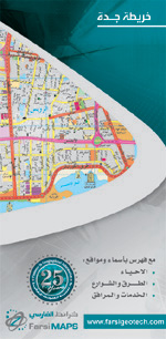
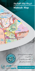
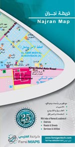
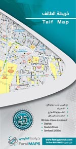
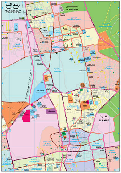
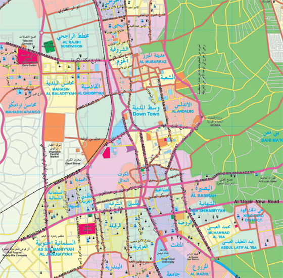
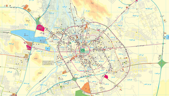
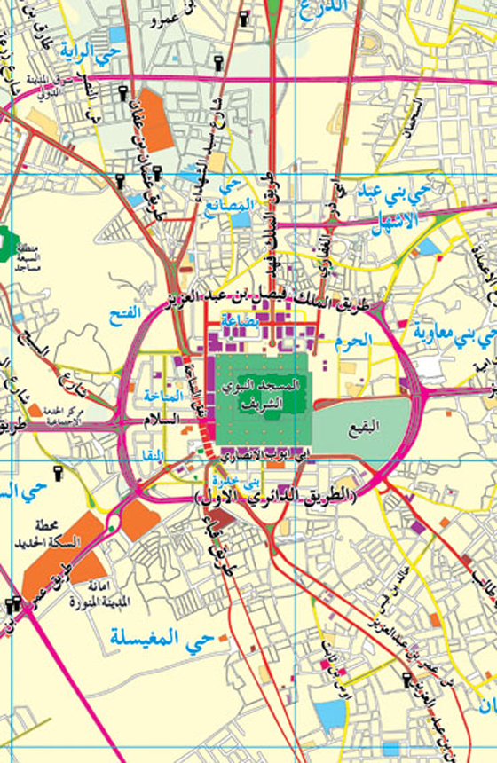
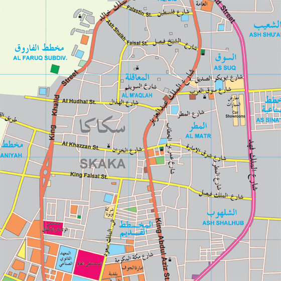
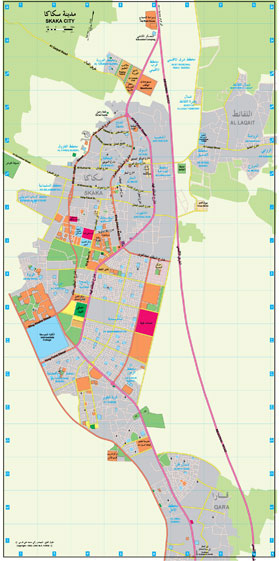
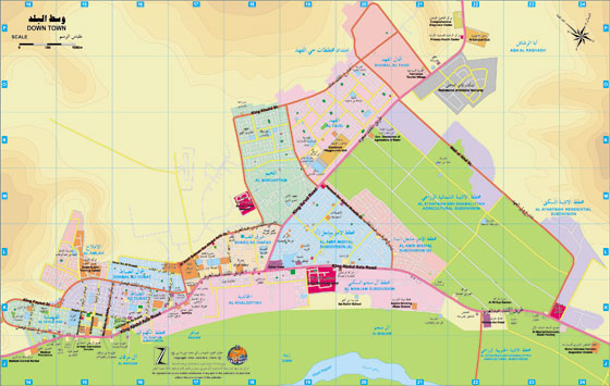
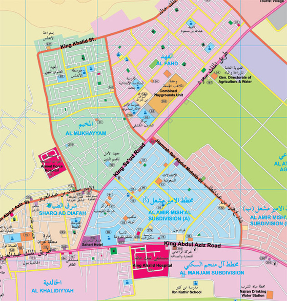
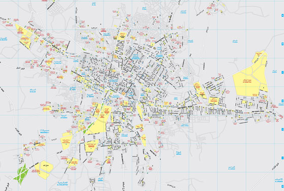
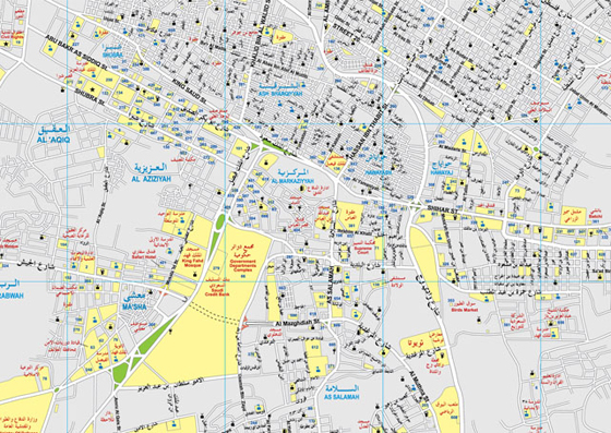
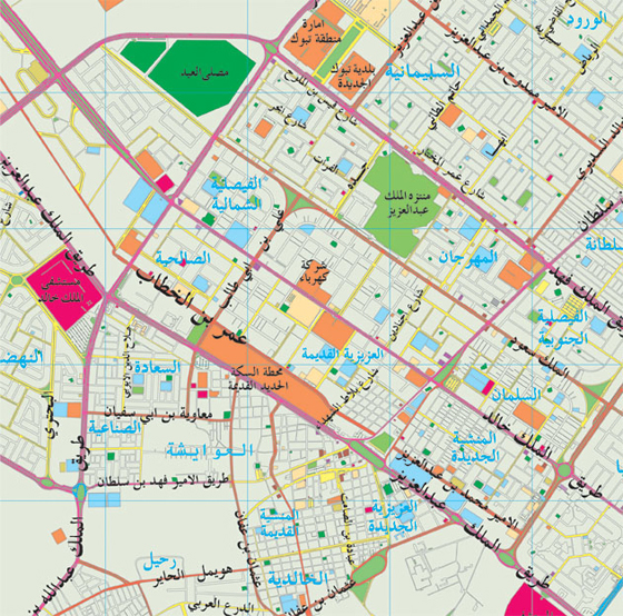
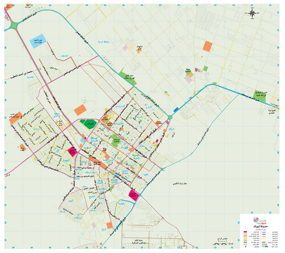
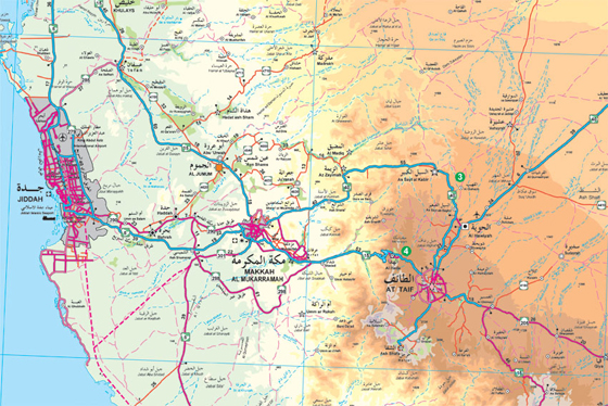
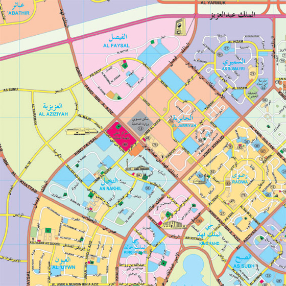
A double-sided folded map of Makkah. (Front) side showing all Makkah and the Holy Places at 1: 25,000 scales. (Back) side showing the built up area of the city at 1:12,500 scale. The Map is showing the distribution of Governmental and Private Services, Hotels, Shopping Center\Malls, Hospitals, Recreation Centers, Car Rental Offices. The map contains an inset for the Holy Mosque (Al Masjid Al Haram) and the surrounding area, Also a map of road network between Jeddah, Makkah and Taif. The map is available in a bilingual version, Arabic and English.

Size : 100cm x 70cm

Price : SR. 28.75

Najran Map

Printed on two sides; (Front) General side showing a map of Najran region. This side contains names and locations of cities and towns in the region with distances between some of the roads linking these places. (Back) Containing a detailed map for Najran,with an inset for down town area, and an index for government and private services, with a list of names for banks, shopping centers, medical services, hotels...etc.

Size : 100cm x 70cm

Scale : 1: 70000

Price : SR. 28.75

Northern Sector Map

This sector covers Tabuk & Jouf areas, showing cities, towns and villages of these areas. MOI and MOMRA classifications, as well as natural features and road networks with distances in KM. between major intersections. (Back, almost common for all sectors)Contains a general map of the Kingdom of Saudi Arabia, useful general and touristic information, an index of cities, towns and villages of this sector.

Size : 100cm x 70cm

Scale : 1: 70000

Price : SR. 28.75

Riyadh Map

A folded map of Riyadh printed on two sides; (Front) General Map showing the districts and streets with their different classifications at 1:58,000 scale with an inset for road networks around Riyadh. (Back) Detailed Map at scale 1:18,000 showing government and private services as well as road network and districts. A list of streets locations for more than 4000 streets, with an index of districts location and also detailed insets for the diplomatic (quarter) districts and King Saud University.

Size : 100cm x 70cm

Price : SR. 28.75

Southern Sector Map

This sector covers Najran, Jazan, Assir, and Baha regions, showing cities, towns and villages of these regions. MOI and MOMRA classifications, as well as natural features and road networks with distance in KM. between major intersections. (Back, almost common for all sectors) Contains a general map of the Kingdom of Saudi Arabia, useful general and touristic information, an index of cities, towns and villages of this sector and a table of distance between major cities.

Size : 100cm x 70cm

Scale : 1: 70000

Price : SR. 28.75

Tabuk Map

Printed on two sides; (Front) General side showing a map of Tabuk Region with names of cities, towns, municipalities, administrative centers, provinces, according to classifications of Ministry of Interior, Ministry of Municipalities and Rural Affairs. It also indicates roads with different classifications (high way, double roads, single roads, arterial roads, under construction roads...etc.) distances in kilometers between the different cities and towns.

Size : 100cm x 70cm

Scale : 1: 26600

Price : SR. 28.75

Western Sector Map

This sector covers Makkah and Madinah regions, showing cities, towns and villages of these regions. MOI and MOMRA classifications as well as the natural features and road network with distance in KM. between major intersections. (Back, almost common for all sectors) Contains a general map of the Kingdom of Saudi Arabia, useful general and touristic information, an index of cities, towns, and villages of this sector and a table of distances between major cities.

Size : 100cm x 70cm

Scale : 1: 70000

Price : SR. 28.75

Yanbu Map

Printed on two sides; (Front) General side showing a map of Yanbu. This side contains names and locations of different services in the area as well as streets and roads in and around the city of Yanbu. (Back) Containing two detailed maps, one for industrial Yanbu and another for the city of Yanbu (known as Naval Yanbu), with an inset for down town area. an index for government and private services and a list of names for (banks, shopping centers, medical services, hotels...etc.)

Size : 100cm x 70cm

Scale : 1: 40000

Price : SR. 28.75

Unlock the Potential of GIS with MAP DEV

Founded in 1982, Map Dev pioneers in geospatial and mapping technologies in Saudi Arabia, providing comprehensive consultative, development, and executive services.

Our Services

Copyright 2024 © Map Dev | All rights reserved.